
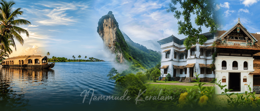
| Core Fact | Kottayam District Details |
|---|---|
| Geographical Location / Status | Central Keralam district. Kottayam lies between the Western Ghats side and the Vembanad–Kuttanad backwater belt. The district has no seacoast. |
| District Headquarters | Kottayam |
| Total Land Area in sq km | 2,208 sq km. |
| Population as per latest available Census data | 1,974,551 as per Census 2011, the latest completed Census data available publicly. |
| Literacy Rate | 97.21%. |
| Number of Rivers / Major Rivers | 3 major rivers officially highlighted: Meenachil, Muvattupuzha, and Manimala. |
| Revenue Divisions | 2 — Kottayam and Pala. |
| Taluks | 5 — Changanacherry, Kanjirappally, Kottayam, Meenachil, and Vaikom. |
| Municipalities | 6 — Kottayam, Changanacherry, Vaikom, Pala, Erattupetta, and Ettumanoor. |
| Number of Grama Panchayats | 71 grama panchayats under 11 blocks. |
| Assembly Constituencies | 9 — Kanjirappally, Poonjar, Changanassery, Ettumanoor, Kottayam, Puthuppally, Pala, Kaduthuruthy, and Vaikom (SC). |
| Lok Sabha Constituency / Constituencies | Kottayam; Mavelikkara (SC) for the Changanassery segment; Pathanamthitta for the Kanjirappally and Poonjar segments. |
| Official District Website | Official District Administration Website, Kottayam District, Government of Keralam. |
What Makes Kottayam Unique?
Kottayam district is one of central Keralam’s most important inland districts.
It is widely associated with letters, latex, lakes, publishing, rubber, and backwater tourism. The district administration describes Kottayam as the land of “letters, legends, latex and lakes.”
A Major Centre of Literacy and Publishing
Kottayam is strongly linked with Keralam’s literacy and print history.
The district is known as Akshara Nagari, meaning the city of letters. The district administration records that Kottayam became India’s first town to achieve 100% literacy in 1989.
Kottayam also has a deep publishing legacy. The official district profile links the district with early English education, the CMS Press, Malayalam publishing, CMS College, and the Sahithya Pravarthaka Co-operative Society.
This makes Kottayam Keralam important for students, writers, publishers, journalists, and researchers.
Rubber, Plantations, and the Rural Economy
Kottayam district has a strong rubber identity.
The district is an important trading centre for spices and commercial crops. Rubber is especially important to its economy. The Rubber Board of India is based in Kottayam.
Rubber plantations shape the rural landscape in Meenachil, Kanjirappally, Pala, Erattupetta, and nearby highland areas.
Backwaters, Hills, and Inland Landscape
Kottayam has no sea coast.
Its western side connects with Vembanad Lake and the Kuttanad backwater region. Its eastern side rises towards the Western Ghats.
This gives Kottayam district a mixed landscape. It has backwaters, paddy fields, midlands, rubber plantations, hills, waterfalls, and highland villages.
Religious and Cultural Heritage
Kottayam society includes Hindu, Christian, and Muslim heritage.
Important religious and heritage centres include Vaikom, Ettumanoor, Mannanam, Bharananganam, Erumeli, Manarcaud, and Thazhathangadi.
The district’s cultural traditions include Margamkali, Arjuna Nritham, Koodiyattam, temple festivals, church festivals, mosque heritage, and literary activity. The official district culture page notes Margamkali and Arjuna Nritham as folk dances of Kottayam.
Geography and Administrative Profile
Location in Keralam
Kottayam district is located in central Keralam.
It is an inland district. It does not border the Arabian Sea. It also does not share an international or interstate border.
Kottayam is connected to Ernakulam, Idukki, Pathanamthitta, and Alappuzha districts. The district’s western side is linked with Vembanad Lake and Kuttanad. Its eastern side moves towards the Western Ghats.
Terrain and Natural Regions
Kottayam has three broad natural divisions:
Highland areas
Midland areas
Lowland areas
Meenachil and Kanjirappally include highland and midland features. Kottayam, Changanassery, and Vaikom include midland and lowland features.
The district has no coastal area. Its lowland character comes mainly from Vembanad Lake, Kuttanad, paddy lands, canals, and backwater-linked settlements.
Major Rivers and Water Bodies
The major rivers of Kottayam district are:
Meenachil River
Muvattupuzha River
Manimala River
The Meenachil River flows through Meenachil, Vaikom, and Kottayam areas. The Muvattupuzha River reaches the Vembanad Lake through Vaikom. The Manimala River flows through Kanjirappally and Changanacherry areas before moving towards Alappuzha.
Vembanad Lake is the most important lake and backwater anchor for Kottayam tourist places. Kumarakom, Pathiramanal access, birdwatching, houseboats, village tourism, and boat races are connected with this lake system.
Revenue Divisions
Kottayam district administration has two revenue divisions:
| Revenue Division | Administrative Importance |
|---|---|
| Kottayam | Serves the central and western administrative side of the district. |
| Pala | Serves the eastern and highland-side administrative areas. |
The official district revenue division list identifies Kottayam and Pala as the two Revenue Divisional Offices.
Kottayam Taluks
Kottayam taluks are:
| Taluk | Local Reference |
|---|---|
| Changanacherry | Southern and western-side taluk with strong transport and education links. |
| Kanjirappally | Eastern highland-side taluk with plantation and hill settlement character. |
| Kottayam | Central taluk containing the district headquarters. |
| Meenachil | Pala-side taluk with rubber, hill, and pilgrim connections. |
| Vaikom | Backwater-side taluk connected with Vembanad Lake and Vaikom heritage. |
The district portal lists 5 taluks and 100 villages.
Kottayam Municipalities
Kottayam municipalities are:
| Municipality | Local Importance |
|---|---|
| Kottayam | District headquarters and major civic centre. |
| Changanacherry | Major town in the southern part of the district. |
| Vaikom | Historic temple town and backwater-side urban centre. |
| Pala | Major town in Meenachil region. |
| Erattupetta | Eastern urban centre near hill and plantation areas. |
| Ettumanoor | Important town near Kottayam and a major temple centre. |
The official district page lists six municipalities.
Panchayat Structure and Major Towns
Kottayam district has 11 blocks and 71 grama panchayats.
Major towns and urban centres include:
Kottayam
Changanacherry
Pala
Vaikom
Ettumanoor
Erattupetta
Kanjirappally
Ponkunnam
Mundakkayam
Kumarakom
These towns support Kottayam local information, public services, education, transport, health care, tourism, trade, and rural administration.
Major Places to Know in Kottayam
| Place | Location | Why It Is Important | Claim to Fame | Short Description |
|---|---|---|---|---|
| Kumarakom | Near Vembanad Lake, about 14 km west of Kottayam town | Backwater tourism, village tourism, resorts, houseboats, and birdwatching | Kumarakom is a well-known backwater village on Vembanad Lake. | Kumarakom is one of the best-known Kottayam tourist places. It is linked with canals, paddy fields, Vembanad Lake, houseboats, and backwater-side local life. |
| Vembanad Lake | Western side of Kottayam district, especially Kumarakom and Vaikom side | Major lake and backwater system | The official tourism page records Vembanad Lake as 83.72 km long and 14.48 km wide. | Vembanad Lake shapes the western identity of Kottayam Keralam. It supports houseboat tourism, fishing, wetland ecology, canals, and boat race traditions. |
| Illickal Kallu | Near Erattupetta, in the Meenachil highland region | Hill viewpoint and natural landmark | The official district tourism page describes Illickal Kallu as a group of hills rising above 4,000 ft. | Illickal Kallu is one of the most recognised hill landmarks in Kottayam district. It represents the district’s eastern highland landscape. |
| Poonjar Palace | Poonjar, Meenachil side | Heritage palace linked with local royal history | Poonjar Palace is listed by the official district tourism page as a key heritage attraction. | Poonjar Palace gives visitors a view of Kottayam’s historical and royal heritage. It is important for students, heritage readers, and local history researchers. |
| Thazhathangadi Juma Masjid | Thazhathangadi, near Kottayam town | Historic mosque and heritage structure | The official district tourism page describes it as one of the oldest mosques in India, about 1,000 years old. | Thazhathangadi Juma Masjid is a major heritage landmark in Kottayam. It reflects the district’s Muslim heritage and old settlement history. |
Citizen Services and Local Infrastructure in Kottayam
Administrative Centers
Kottayam district administration is centred around the District Collectorate in Kottayam.
The Collectorate handles major revenue, disaster management, election, public grievance, and district-level administrative functions. The official district page lists the Collectorate at Collectorate P.O., Kottayam.
Key administrative centres include:
| Service Centre | Local Role |
|---|---|
| District Collectorate, Kottayam | Main district administration centre. |
| Revenue Divisional Office, Kottayam | Revenue division office for Kottayam-side areas. |
| Revenue Divisional Office, Pala | Revenue division office for Pala-side areas. |
| Taluk Offices | Located under Changanacherry, Kanjirappally, Kottayam, Meenachil, and Vaikom taluks. |
| Municipal Offices | Kottayam, Changanacherry, Vaikom, Pala, Erattupetta, and Ettumanoor. |
| Block Panchayat Offices | Serve the 11 block-level rural administration areas. |
| Grama Panchayats | Serve 71 village-level local self-government areas. |
Police and Courts
Kottayam district has a District Police Office headed by the District Police Chief. The official district police page also lists 112 as the emergency number.
The district court structure includes the District Court Complex at Kottayam. The official courts page lists the Principal District and Sessions Court at Collectorate P.O., Kottayam. It also lists court centres in locations such as Kanjirappally, Pala, Ettumanoor, Erattupetta, Changanacherry, and Vaikom.
Health Infrastructure
Kottayam has important public health infrastructure.
Major public health institutions include:
| Institution | Local Importance |
|---|---|
| Government Medical College Hospital, Gandhinagar, Kottayam | Major tertiary public hospital and medical education institution. |
| General Hospital, Kottayam | Major district-level government hospital in Kottayam town. |
| General Hospital, Kanjirappally | Important public hospital for eastern and highland areas. |
| Government hospitals and taluk-level hospitals | Serve urban, semi-urban, and rural populations. |
| Primary Health Centres and Family Health Centres | Serve panchayat-level public health needs. |
Government Medical College, Kottayam was established in 1962 and is one of Keralam’s older government medical colleges.
The official district public utility listings include Government Medical College Hospital and General Hospital, Kottayam.
Education Infrastructure
Kottayam is one of Keralam’s strongest education districts.
Important education institutions include:
| Institution / Category | Importance |
|---|---|
| Mahatma Gandhi University | Major state university associated with Kottayam and nearby districts. |
| CMS College, Kottayam | Historic college linked with Keralam’s modern education history. |
| Government colleges | Serve arts, science, commerce, and professional education needs. |
| Aided colleges | Important in Kottayam’s long education tradition. |
| Technical and professional colleges | Support engineering, nursing, medicine, pharmacy, and teacher education. |
| Public libraries and publishing institutions | Support Kottayam’s literary identity. |
Mahatma Gandhi University was established on 2 October 1983. Its jurisdiction includes Kottayam, Ernakulam, Idukki, and parts of Pathanamthitta.
The district portal lists colleges and universities in Kottayam, including CMS College, Baselius College, BCM College for Women, Assumption College, and Amal Jyothi College of Engineering.
Transport Infrastructure
Kottayam is an important inland transport district.
| Transport Type | Key Local Information |
|---|---|
| Railway | Kottayam Railway Station is a major rail point in the district. |
| Bus Transport | KSRTC stations include Kottayam, Changanassery, Erattupetta, Pala, Ponkunnam, and Vaikom. |
| Airport | There is no airport inside Kottayam district. Cochin International Airport is the nearest major airport for many parts of Kottayam. |
| Road Corridors | MC Road / SH-1 and NH 183 are important road corridors serving Kottayam-side movement. |
| Water Transport | Kumarakom, Vembanad Lake, Vaikom-side waterways, canals, and houseboat routes support backwater movement and tourism. |
Kottayam’s transport pattern is shaped by rail, KSRTC bus stations, state road corridors, highland roads, and Vembanad backwater access.
Economy and Local Livelihoods
Rubber and Plantation Economy
Rubber is one of the strongest economic identifiers of Kottayam district.
The district is closely linked with natural rubber cultivation, rubber trade, rubber processing, and the Rubber Board of India.
Rubber supports small farmers, plantation workers, traders, transport workers, processors, and local service providers.
Agriculture and Commercial Crops
Kottayam’s agriculture includes rubber, coconut, paddy, banana, spices, and mixed homestead farming.
The district’s geography supports different crop patterns:
Paddy and wetland agriculture in lowland areas
Rubber and mixed farming in midland areas
Plantation crops in highland areas
Coconut and homestead crops across villages
This agricultural base influences local markets, transport, land use, and rural livelihoods.
Backwater Tourism and Hospitality
Tourism is important in Kumarakom, Vembanad Lake, Vaikom, Illickal Kallu, Poonjar, and heritage areas.
Kumarakom supports resorts, homestays, houseboats, birdwatching, canoe routes, and responsible tourism activities.
Tourism also creates local work in transport, food services, guides, crafts, boating, and hospitality.
Publishing, Education, and Services
Kottayam has a major publishing and education identity.
The official culture page states that Kottayam has played a leading role in education, mass communication, printing, and book publication. It also notes the role of Malayala Manorama, Bhashaposhini, Deepika, SPCS, DC Books, and Current Books in the district’s cultural economy.
Education, health care, government services, banking, retail trade, transport, and migration-linked household income also shape Kottayam’s modern service economy.
Culture, Language, and Society
Languages
Malayalam is the main language of Kottayam district.
English is also widely used in education, administration, publishing, health care, and professional services. Hindi and Tamil may be heard in trade, transport, tourism, and migrant worker settings.
Cultural Traditions
Kottayam has a strong literary, religious, educational, and festival culture.
Its cultural identity includes:
Malayalam literature and publishing
Church traditions
Temple festivals
Mosque heritage
Backwater village life
Rubber plantation communities
Education-focused social life
The official district culture page says Kottayam holds a prominent place in Keralam’s cultural map.
Traditional Art Forms
Important art and cultural forms connected with Kottayam include:
| Art / Cultural Form | Local Relevance |
|---|---|
| Margamkali | Associated with the Syrian Christian community of erstwhile Travancore. |
| Arjuna Nritham | Listed among Kottayam’s folk dances. |
| Koodiyattam | Ancient Sanskrit theatre tradition of Keralam. |
| Temple arts and percussion | Seen in temple festivals and local cultural events. |
| Literary and publishing culture | Central to Kottayam’s modern cultural identity. |
The official district culture page specifically mentions Margamkali, Arjuna Nritham, and Koodiyattam.
Festivals and Religious Heritage
Kottayam’s public culture includes Hindu, Christian, and Muslim festivals.
The official district festivals page lists Ettumanoor Ezhara Ponnana, Vaikom Ashtami Ulsavam, Ramadan, Christmas, and Onam.
Major religious and heritage anchors include:
Ettumanoor Mahadeva Temple
Vaikom Mahadeva Temple
Thazhathangadi Juma Masjid
Mannanam
Bharananganam
Manarcaud
Erumeli
Kuravilangad
These places make Kottayam local information useful for pilgrims, tourists, students, and district-level researchers.
Food and Local Lifestyle
Kottayam’s food identity reflects central Keralam and backwater influences.
Common local food patterns include rice, coconut-based curries, tapioca, fish dishes, appam, puttu, and traditional Keralam meals. Backwater-side areas such as Kumarakom and Vaikom also connect food with fishing, waterways, and village tourism.
Lifestyle patterns vary across the district.
Kumarakom and Vaikom have backwater and lake-side settlements. Pala, Erattupetta, Kanjirappally, and Mundakkayam have stronger hill, rubber, and plantation connections. Kottayam town, Changanacherry, Ettumanoor, and Pala serve as education, trade, health, and transport centres.
Suggested Official Sources to Verify
Official District Administration Website
Keralam Government Portal
Keralam Tourism
Census of India
Local Self Government Department, Keralam
Keralam Legislative Assembly
Election Commission of India
Keralam Police
Keralam Health Services
Mahatma Gandhi University
Keralam Public Works Department
National Highways Authority of India
Frequently Asked Questions About Kottayam
What are the taluks in Kottayam district?
The taluks in Kottayam district are Changanacherry, Kanjirappally, Kottayam, Meenachil, and Vaikom. These five Kottayam taluks form the main revenue administration structure of the district.
What is Kottayam district famous for?
Kottayam district is famous for literacy, publishing, rubber plantations, the Rubber Board, Vembanad Lake, Kumarakom backwaters, religious heritage, and its identity as the land of letters, legends, latex, and lakes. It is also known as Akshara Nagari because of its strong connection with education, literature, printing, and book publishing.
Which are the major tourist places in Kottayam?
Major tourist places in Kottayam include Kumarakom, Vembanad Lake, Kumarakom Bird Sanctuary, Illickal Kallu, Poonjar Palace, Thazhathangadi Juma Masjid, Vaikom, Ettumanoor, Malarikkal, Aruvikuzhy Waterfalls, and Ilaveezhapoonchira. These places represent the district’s backwaters, hills, wetlands, heritage buildings, religious sites, and rural landscapes.